Tour de Zwift will be the largest series of events ever held on Zwift. It’s a 7-stage series, and for each stage Zwifters get to choose between group rides, bike races, and runs. Do just one, or do all three!
Here’s everything we know about TdZ 2020. This page will be constantly updated as new info (stage routes, etc) is released.
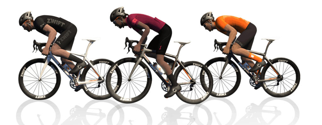
Ride or Race
One big change from prior TdZs is Zwift offering riders the opportunity to race each stage. Many riders in the past unofficially raced the stages–but this year Zwift has official race events separate from group ride events.
Group ride events will use double draft mode to help riders stick together and move along at a brisk pace. Race events will use Zwift’s standard draft.
Learn more about TdZ’s open races >
You’ve Got Options
With stages spanning a few days apiece and each group ride category and race covering a different route, Zwifters have several route and effort-level options for each stage.
Can’t get enough TdZ? Ride multiple events in each stage. Perhaps you’d like to enjoy a brisk group ride on a longer route, and race a shorter route? Do it!
Categories
As mentioned above, each stage includes separate group ride and race events.
For group ride events, the category (A, B, C) selected determines your route. This gives riders more control over the length and difficulty of their ride.
- A: long route
- B: shorter/easier route
- C: women only
Race events use the same route regardless of category selection. Racers, choose your category based on FTP w/kg, like most Zwift races:
Mixed (Men & Women) Race Categories
- A: 4-5 w/kg
- B: 3.2-3.9 w/kg
- C: 2.5-3.1 w/kg
- D: 1-2.4 w/kg
Women’s Race Categories
- A: 3.7-5 w/kg
- B: 3.2-3.69 w/kg
- C: 2.5-3.19 w/kg
- D: 1-2.49 w/kg
Stage Details
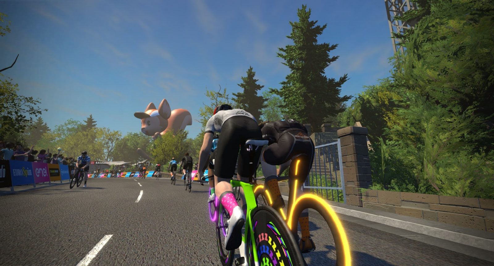
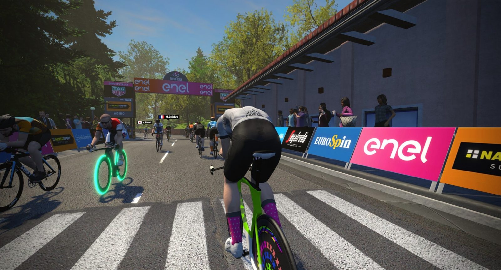
Stage 1 (London): Jan 12-15 (click for route details)
The London course's "Classique" route takes you on some of the most famous London streets including Strand, The Mall, Constitution Hill, and Birdcage Walk. You ride by Trafalgar Square and Buckingham Palace.
It is a precise replica of the Prudential RideLondon Classique route, which is described as "beginning on The Mall in St James’s Park, going up Constitution Hill, turning at the top to come down and on to Birdcage Walk, then passing Big Ben and turning left on to Whitehall and right on to the Strand before turning again to come back up the Strand, through Trafalgar Square, Admiralty Arch and back on to The Mall."
Route details:
Distance: 5.4 km (3.3 miles)
Elevation Gain: 19m (62')
[button link="https://www.strava.com/segments/12749761" color="black" newwindow="yes"] Strava Forward Segment[/button][button link="https://www.strava.com/segments/19480641" color="black" newwindow="yes"] Strava Reverse Segment[/button][button link="https://www.strava.com/segments/19480660" color="black" newwindow="yes"] Strava Reverse Segment Leadin from Start Banner[/button]Start Points and Lead-Ins
When choosing this route to free ride you will begin near the start of the Classique sprint. If you are riding this for an event, you will begin in the London start pens which means a lead-in of approximately 3.9km/2.4 miles before you begin your first Classique lap.
The Strava segments below begin and end at the start/finish banner located on The Mall, not the main start/finish banner where the game starts your ride.
Stage 2 (Innsbruck): Jan 16-19 (click for route details)
Innsbruck's flagship route is actually just a portion of the 2018 UCI Worlds course which was raced in September 2018.
Route details:
Distance: 23.6km (14.7 miles)
Elevation Gain: 487m (1598')
[button link="https://www.strava.com/segments/18397725" color="black" newwindow="yes"] Strava Forward Segment[/button][button link="https://www.strava.com/segments/18397965" color="black" newwindow="yes"] Strava Segment (climb only)[/button]Route Profile
It begins in Innsbruck on a flat road which crosses the Sill River then heads beneath the Inntal Autobahn overpass before hitting the big climb. At 7.4km (4.6 miles) with an average grade of 5.4%, the Innsbruck climb is similar to Watopia's Epic KOM in terms of difficulty.
Enjoy the descent, but don't rest too much: you've still got a sprint coming! Head back into town and see if you can make the leaderboard for the sprint along the Inn River (the town's namesake) before crossing the finish line.
UCI Race Details
At the UCI Worlds race, the men’s elite racers began in Kufstein and ride 84.7km to Innsbruck, where they covered this circuit 7 times. And if that wasn't painful enough, the final circuit (not part of the Zwift's Innsbruck course at this time) was a modified one which included an additional climb featuring 25% gradients! Spain's Alejandro Valverde won the 2018 UCI Worlds Elite race from a final pack sprint of four riders. See the finish >
Stage 3 (Watopia): Jan 20-23 (click for route details)
Watopia's "Hilly Route" was the very first route on the island. It includes KOM and sprint sections in both directions.
Stage 4 (Bologna): Jan 24-27 (click for route details)
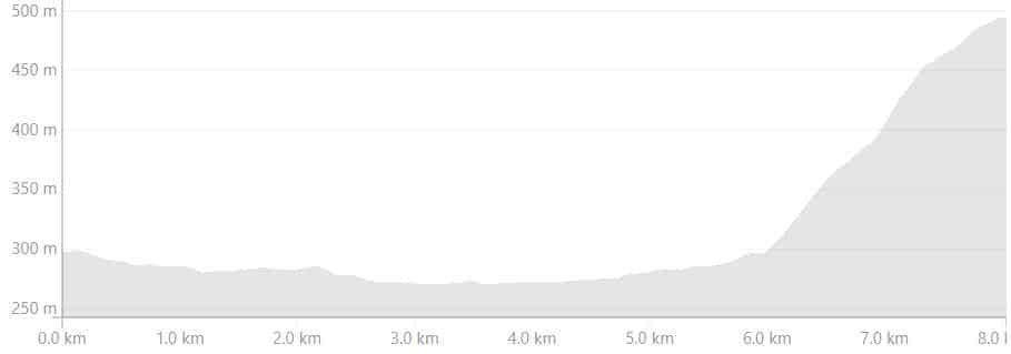
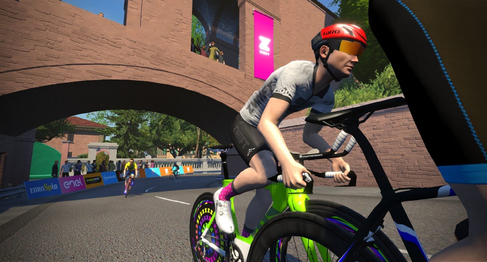
As a GPS-perfect replica of a grand tour stage, this route is a first for Zwift. The Bologna "Time Trial Lap" route is a replica of the Giro d'Italia prologue TT stage raced on May 11, 2019. The first 3km of this route are actually slightly downhill--enjoy it while it lasts! The next 3km are a false flat. Then you hit the flat right-hand hairpin at 6km it's a hard 2k climb to the finish. The climb averages 9.6%, with a total elevation gain of 198m (649'). Most Zwifters spend roughly half of their race on the flat portion of the course, and half on the climb. For pacing tips on this route read "How to Pace Your Best Bologna TT Race". If you aren't half-blind from an all-out effort you can enjoy some of the landmarks painstakingly recreated by Zwift's artists. We begin at Piazza Maggiore, which is the main square in the heart of Bologna. Other sights here include the Basilica di San Petronio and Fountain of Neptune. Next, we cover some cobbled streets lined with arcades, past Porta San Felice (the westernmost gate of medieval Bologna). The climb begins at Arco del Meloncello with a sharp right hairpin. You'll know you're halfway up the climb when you hit another right hairpin and go under the stone arch. When you see the Sanctuary of the Madonna di San Luca you'll know you're almost there. And when you see the giant Scottie inflatable, give it all you've got over the line! Single-lap events on this route are straightforward enough: it's 8km (5 miles) long, beginning at the start line and ending at the top of the climb. But what about multi-lap events? Many races held on Bologna TT are 2-lap events, but that's a rather confusing way to describe them. The best way to understand this is to know that a "lap" on Bologna TT is just one time riding from the start to the hilltop finish. Descending back to the start line isn't counted as a "lap" in any way. Therefore, a 2-lap event on this route means you still begin at the standard start line, climb to the top, descend down to the start again, turn around, then climb to the top once more. Your event will end atop the second climb, for a total length of 24km (15 miles). Bologna TT is an event-only course, meaning you can only get on the course if you join an event being held there. Want to free-ride the course? Join the event, then click to leave the event. You will remain on the course after leaving the event. Distance: 8km (5 miles)Route Profile
Sightseeing


About Multi-Lap Events
Event Only
Route Details
Elevation Gain: 230m (757')
[button link="https://www.strava.com/segments/20560239" color="black" newwindow="yes"] Strava Segment[/button][button link="https://www.strava.com/segments/20560807" color="black" newwindow="yes"] Strava Segment (Reverse)[/button][button link="https://www.strava.com/segments/20581507" color="black" newwindow="yes"] Strava Segment (Out and Back)[/button][button link="https://www.strava.com/segments/20581369" color="black" newwindow="yes"] Strava Segment (Flat Only)[/button][button link="https://www.strava.com/segments/20560392" color="black" newwindow="yes"] Strava Segment (Climb Only)[/button]
As a GPS-perfect replica of a grand tour stage, this route is a first for Zwift. The Bologna "Time Trial Lap" route is a replica of the Giro d'Italia prologue TT stage raced on May 11, 2019. The first 3km of this route are actually slightly downhill--enjoy it while it lasts! The next 3km are a false flat. Then you hit the flat right-hand hairpin at 6km it's a hard 2k climb to the finish. The climb averages 9.6%, with a total elevation gain of 198m (649'). Most Zwifters spend roughly half of their race on the flat portion of the course, and half on the climb. For pacing tips on this route read "How to Pace Your Best Bologna TT Race". If you aren't half-blind from an all-out effort you can enjoy some of the landmarks painstakingly recreated by Zwift's artists. We begin at Piazza Maggiore, which is the main square in the heart of Bologna. Other sights here include the Basilica di San Petronio and Fountain of Neptune. Next, we cover some cobbled streets lined with arcades, past Porta San Felice (the westernmost gate of medieval Bologna). The climb begins at Arco del Meloncello with a sharp right hairpin. You'll know you're halfway up the climb when you hit another right hairpin and go under the stone arch. When you see the Sanctuary of the Madonna di San Luca you'll know you're almost there. And when you see the giant Scottie inflatable, give it all you've got over the line! Single-lap events on this route are straightforward enough: it's 8km (5 miles) long, beginning at the start line and ending at the top of the climb. But what about multi-lap events? Many races held on Bologna TT are 2-lap events, but that's a rather confusing way to describe them. The best way to understand this is to know that a "lap" on Bologna TT is just one time riding from the start to the hilltop finish. Descending back to the start line isn't counted as a "lap" in any way. Therefore, a 2-lap event on this route means you still begin at the standard start line, climb to the top, descend down to the start again, turn around, then climb to the top once more. Your event will end atop the second climb, for a total length of 24km (15 miles). Bologna TT is an event-only course, meaning you can only get on the course if you join an event being held there. Want to free-ride the course? Join the event, then click to leave the event. You will remain on the course after leaving the event. Distance: 8km (5 miles)Route Profile
Sightseeing
About Multi-Lap Events
Event Only
Route Details
Elevation Gain: 230m (757')
[button link="https://www.strava.com/segments/20560239" color="black" newwindow="yes"] Strava Segment[/button][button link="https://www.strava.com/segments/20560807" color="black" newwindow="yes"] Strava Segment (Reverse)[/button][button link="https://www.strava.com/segments/20581507" color="black" newwindow="yes"] Strava Segment (Out and Back)[/button][button link="https://www.strava.com/segments/20581369" color="black" newwindow="yes"] Strava Segment (Flat Only)[/button][button link="https://www.strava.com/segments/20560392" color="black" newwindow="yes"] Strava Segment (Climb Only)[/button]
Stage 5 (New York): Jan 28-31 (click for route details)
Stage 6 (Richmond): Feb 1-4 (click for route details)
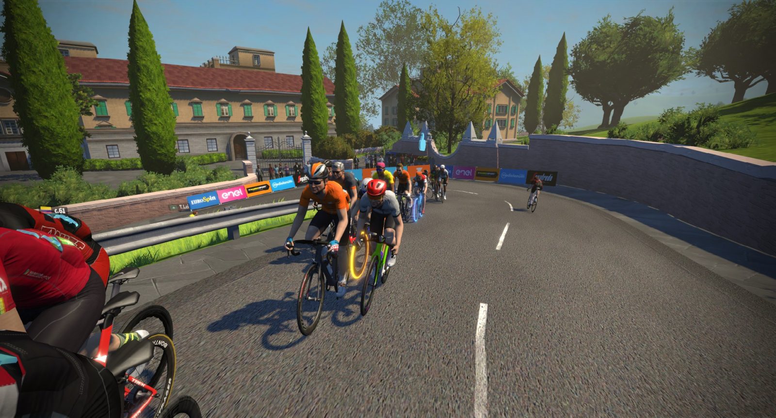
The Richmond UCI Worlds route is a replica of the 2015 UCI Road World Championships course in Richmond, Virginia, USA. It was at this race where Peter Sagan famously attacked on 23rd Street to eventually win his first World Champs jersey.
It's a wonderful race course, with the first half very flat, then a nice mix of attackable climbs on the back half.
The Richmond refresh of February 6, 2020 added the ability to u-turn on Richmond, while also adding the reverse version of the 2015 UCI Worlds course as an event-only route.
Distance: 16.3km (10.1 miles)
Elevation Gain: 142m (467′) [button link="https://www.strava.com/segments/12128718" color="black" newwindow="yes"]Strava Forward 1 Lap[/button] [button link="https://www.strava.com/segments/22809649" color="black" newwindow="yes"]Strava Reverse 1 Lap[/button]
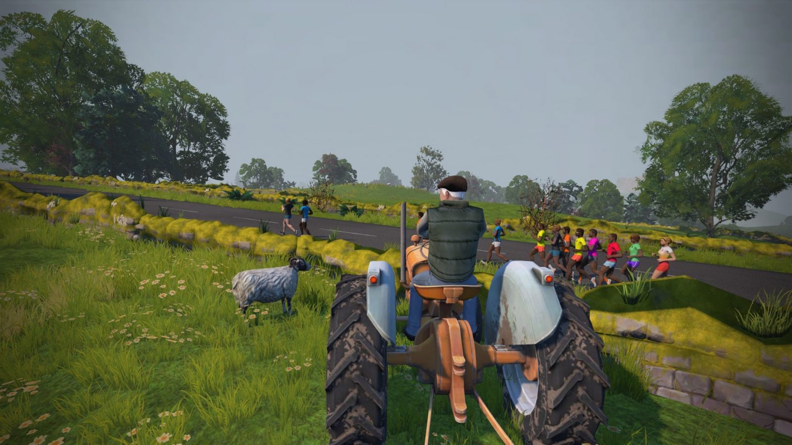
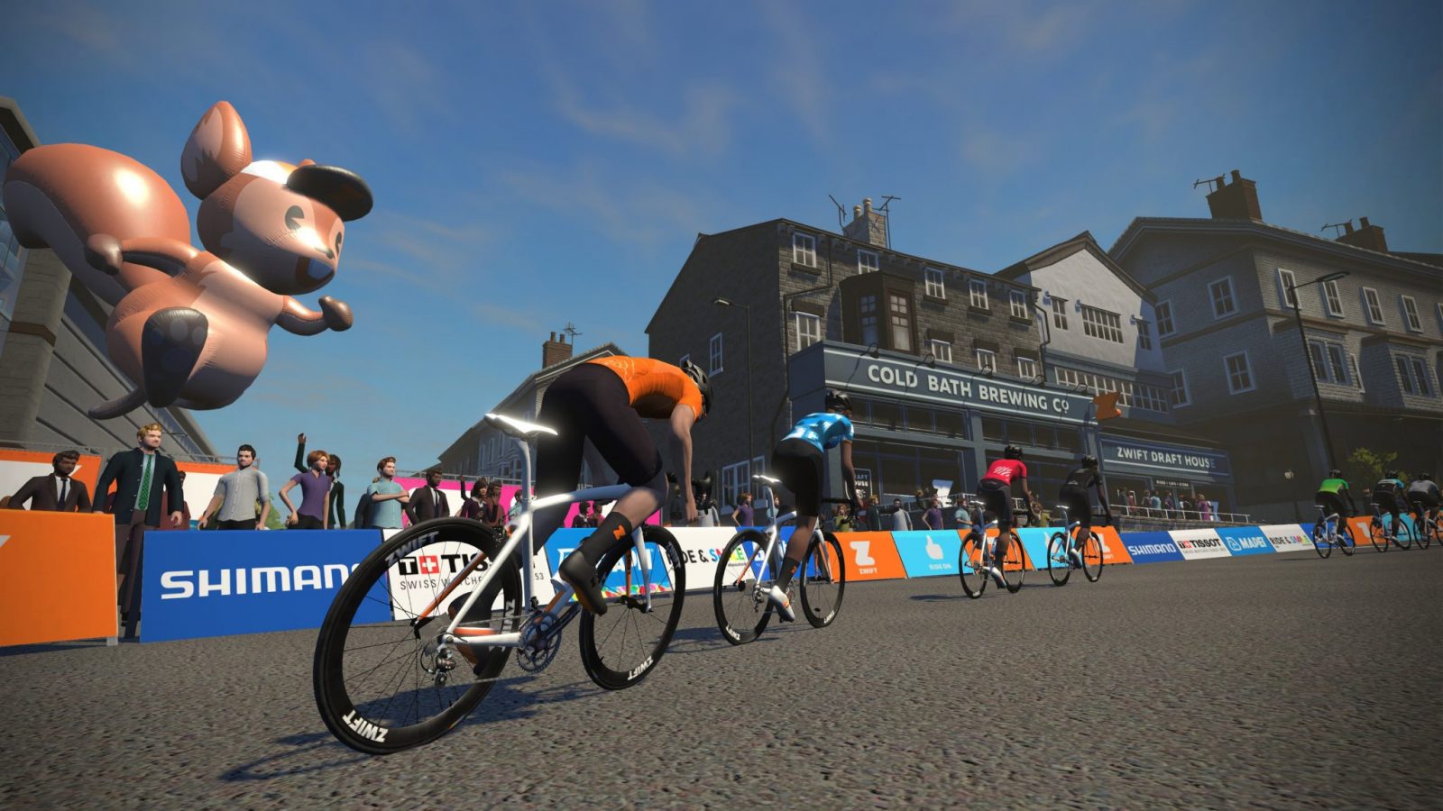
Stage 7 (Yorkshire): Feb 5-8 (click for route details)
One of six routes rolled out with Zwift's UCI 2019 Worlds map, "2019 UCI Worlds Harrogate Circuit" covers the actual finishing circuit which the world's top road racers will race in September's 2019 UCI Worlds events. The women's elite riders will cover 3 laps after their lead in segment, while the men's elite riders will do 7 laps. Roll through the start/finish banner in Harrogate, then turn right to head up Otley Road, the longest section of straight road on the Yorkshire course. As you make your way out of Harrogate proper you'll find yourself in the farm lands. Look for sheep, cows, and a friendly farmer on his tractor. The Yorkshire KOM begins when you hit the stone bridge and turn a sharp left. The stream crossed here is called Oak Beck (“Beck” is used often in Yorkshire for a small river or stream). In real life, this bridge is narrow and crossing-controlled by traffic lights to be one way. But we Zwifters get to roll on through. Hit that KOM, enjoy your descent, then turn a sharp left past the Royal Pumproom onto Millionaire's Row. You're now on Cornwall Road, in the Duchy Estate--one of the poshest places in all of England to live. Your next right takes you onto the forward sprint, a short but punchy effort which is mostly uphill until the final few meters. Finish that sprint, enjoy your descent, and wrap up your loop of the Duchy Estate. (Note: the sprint is so short that Strava will not let us create a segment.) You will pass the Royal Pumproom again (this time on your right). In the 18th and 19th centuries, Harrogate made its fortune by drawing often wealthy people to come and take its waters, which had a supposedly curative effect. Known locally as "The Pump Rooms", this is one location where these waters emerged from the ground. As you turn the last right before the finish, note the Zwift Draft House on your left. This is the Cold Bath Brewery where Zwift is setting up shop and giving away its own custom brews during 2019 Worlds Week. Almost there! The straightaway to the finish is uphill, so if you're racing be ready for an especially challenging effort in these final meters. You will pass "Scotty's" on the left, which in real life is Betty's Tearooms, a huge local landmark. This final sprint is where Mark Cavendish famously crashed out of the 2014 Tour de France. Happily, Zwifters don't need to worry about such dangers, but you can certainly appreciate the massive effort put forth in this final drag to the finish. Special thanks to Simon Schofield from the Zwiftcast for helping us put together these route notes. Simon is a Yorkshireman who has ridden these roads hundreds of times, so his local knowledge proved invaluable to us and to Zwift, who used his input to create and name Yorkshire's routes. There is a reverse version of this route, but it is event-only and thus only used for official events. See Strava segment below. There isn't much that is flat in Yorkshire, but the climbs are never long, either. Route details:Route Description
Reverse Version
Profile
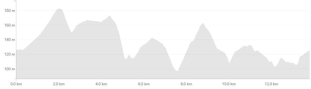
Distance: 13.8km (8.6 miles)
Elevation Gain: 240m (787')
[button link="https://www.strava.com/segments/21738724" color="black" newwindow="yes"]Strava Segment (Banner to Banner)[/button][button link="https://www.strava.com/segments/21766077" color="black" newwindow="yes"]Strava Segment (from Start Pens)[/button][button link="https://www.strava.com/segments/21747707" color="black" newwindow="yes"]Strava Segment (Reverse, Banner to Banner)[/button] [button link="https://www.strava.com/segments/21747707" color="black" newwindow="yes"]Strava Segment (Reverse, from Start Pens)[/button]
One of six routes rolled out with Zwift's UCI 2019 Worlds map, "2019 UCI Worlds Harrogate Circuit" covers the actual finishing circuit which the world's top road racers will race in September's 2019 UCI Worlds events. The women's elite riders will cover 3 laps after their lead in segment, while the men's elite riders will do 7 laps. Roll through the start/finish banner in Harrogate, then turn right to head up Otley Road, the longest section of straight road on the Yorkshire course. As you make your way out of Harrogate proper you'll find yourself in the farm lands. Look for sheep, cows, and a friendly farmer on his tractor. The Yorkshire KOM begins when you hit the stone bridge and turn a sharp left. The stream crossed here is called Oak Beck (“Beck” is used often in Yorkshire for a small river or stream). In real life, this bridge is narrow and crossing-controlled by traffic lights to be one way. But we Zwifters get to roll on through. Hit that KOM, enjoy your descent, then turn a sharp left past the Royal Pumproom onto Millionaire's Row. You're now on Cornwall Road, in the Duchy Estate--one of the poshest places in all of England to live. Your next right takes you onto the forward sprint, a short but punchy effort which is mostly uphill until the final few meters. Finish that sprint, enjoy your descent, and wrap up your loop of the Duchy Estate. (Note: the sprint is so short that Strava will not let us create a segment.) You will pass the Royal Pumproom again (this time on your right). In the 18th and 19th centuries, Harrogate made its fortune by drawing often wealthy people to come and take its waters, which had a supposedly curative effect. Known locally as "The Pump Rooms", this is one location where these waters emerged from the ground. As you turn the last right before the finish, note the Zwift Draft House on your left. This is the Cold Bath Brewery where Zwift is setting up shop and giving away its own custom brews during 2019 Worlds Week. Almost there! The straightaway to the finish is uphill, so if you're racing be ready for an especially challenging effort in these final meters. You will pass "Scotty's" on the left, which in real life is Betty's Tearooms, a huge local landmark. This final sprint is where Mark Cavendish famously crashed out of the 2014 Tour de France. Happily, Zwifters don't need to worry about such dangers, but you can certainly appreciate the massive effort put forth in this final drag to the finish. Special thanks to Simon Schofield from the Zwiftcast for helping us put together these route notes. Simon is a Yorkshireman who has ridden these roads hundreds of times, so his local knowledge proved invaluable to us and to Zwift, who used his input to create and name Yorkshire's routes. There is a reverse version of this route, but it is event-only and thus only used for official events. See Strava segment below. There isn't much that is flat in Yorkshire, but the climbs are never long, either. Route details:Route Description
Reverse Version
Profile
Distance: 13.8km (8.6 miles)
Elevation Gain: 240m (787')
[button link="https://www.strava.com/segments/21738724" color="black" newwindow="yes"]Strava Segment (Banner to Banner)[/button][button link="https://www.strava.com/segments/21766077" color="black" newwindow="yes"]Strava Segment (from Start Pens)[/button][button link="https://www.strava.com/segments/21747707" color="black" newwindow="yes"]Strava Segment (Reverse, Banner to Banner)[/button] [button link="https://www.strava.com/segments/21747707" color="black" newwindow="yes"]Strava Segment (Reverse, from Start Pens)[/button]
Makeup Days: Feb 10-16
Sign up for events at Zwift.com or via Zwift Companion
See all upcoming TdZ events at ZwiftHacks.com >
Prizes and Unlocks
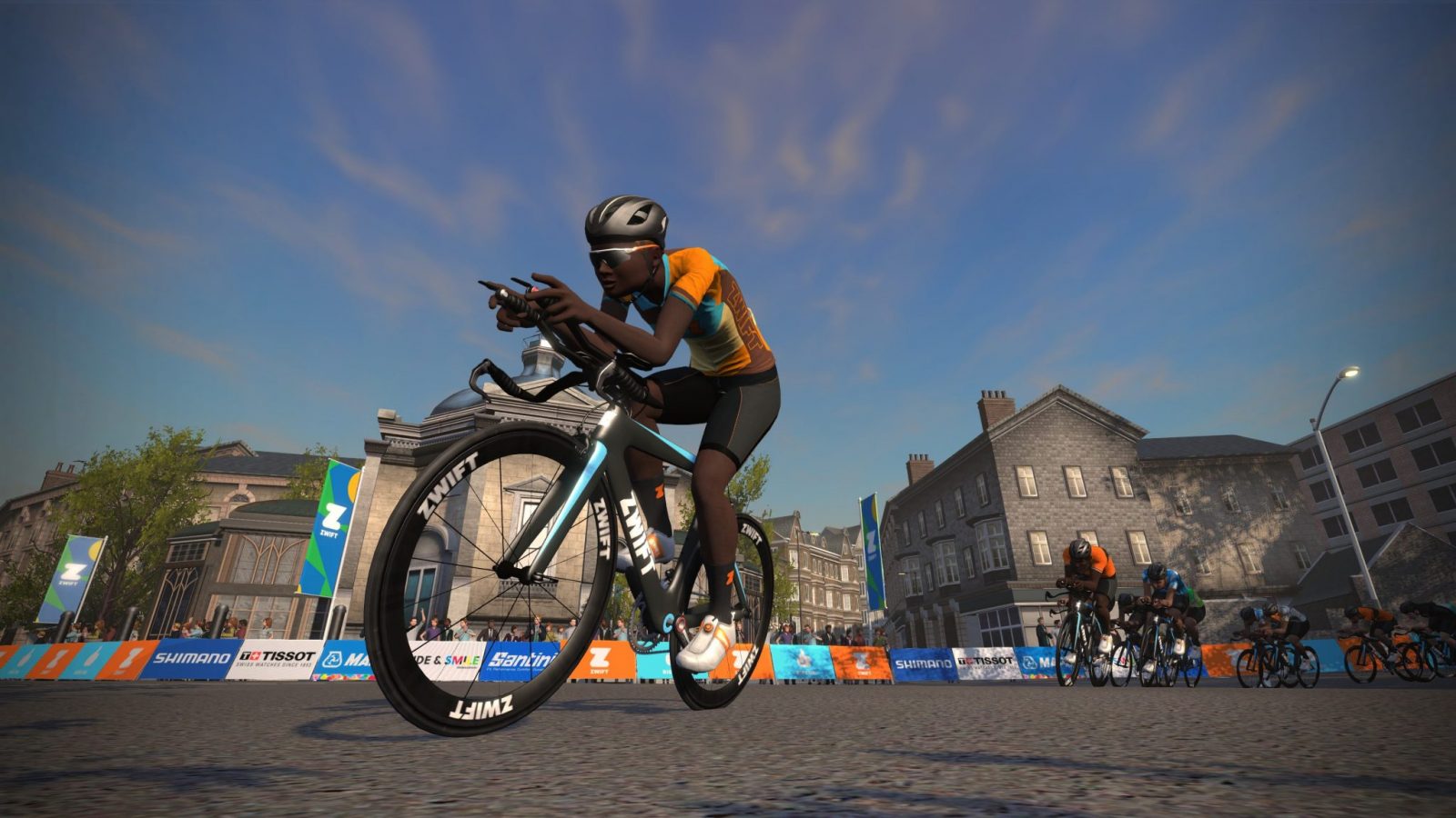
Complete all stages to unlock the exclusive TdZ 2020 kit. This is the kit you’ve seen riders have been wearing for all the TdZ events.
Pro-Am Invitational Races on Tour de Zwift Live
Another new and fun addition to this year’s TdZ is Zwift’s Pro-Am Invitational race seres. These live-streamed invitational races feature top riders taking on the same course we’ll all race, the day before each stage begins. Read all about it here >
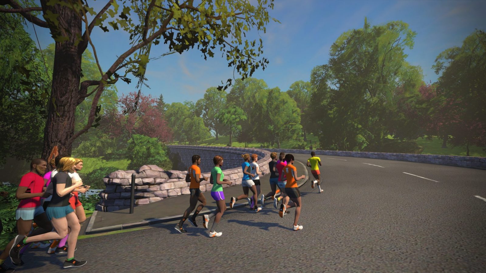
TdZ for Runners
There is also a TdZ for Runners happening at the same time as TdZ for Riders. It has its own (secret) unlock and set of 7 stages.
We will publish a separate post covering this, once we get more details.
Registration
Riders and Runners can register for the TdZ using the links below. This just gets you signed up for the overall Tour(s), meaning Zwift will send you reminder emails, etc. You will still need to sign up for each specific stage.
Register for TdZ Ride >
Register for TdZ Run >
Questions or Comments?
Share them below, and we’ll do our best to get answers!
