

Today, we’re releasing the first of three special “full map” Rebel Routes. Unlike the very small Summit City Velodrome, the last Rebel Route we released, these routes are very long, covering every single road on their respective maps.
But first, credit where credit is due: Zwifter Ole Eichhorn gets the kudos for putting in the work to come up with this route. And it was no small job! Finding the shortest route covering all roads on a complex map is known as “the postman problem”, and Ole wrote a program to solve it, telling me that “the Internet knows a lot of tricks.”
Ole went on to say, “The program uses Hierholtzer’s algorithm to find a Eulerian path, the Floyd-Warshall algorithm to pair odd nodes, and Djikstra’s algorithm to find minimum node pairings. (Yeah, just typing that makes my head hurt.)”
Not only did Ole find the shortest route – he went and rode it! Fine work, sir.
Second: I’m releasing these three Rebel Routes in hopes that Zwift will adopt them as new fondo routes. It’s been way too long since we’ve had new fondo routes, and there are so many great new roads that fondos could use! (All three routes are from Ole, and all three are “full map” routes.)
This route in particular would make a great Medio Fondo route, and the next two routes released will make good Bambino and Gran routes, respectively. Stay tuned for those.
About Rebel Routes
“Rebel Routes” are Zwift rides not available on Zwift’s routes list, thus requiring manual navigation.
The reward for your rebel ride? Exploring a new route, knowing you’ve gone where few Zwifters have gone before. And a Strava segment rank in the tens or hundreds instead of the thousands! Rebel Routes are also included as a separate category on our Veloviewer Route Hunter leaderboard.
Route Description
A complete turn-by-turn tour of this route would take much too much space. So I’ll summarize it instead.
The route begins in the Yumezi countryside, which is fitting since this is where it all began! When the Makuri Islands map launched in May of 2021, these were the only roads it had.
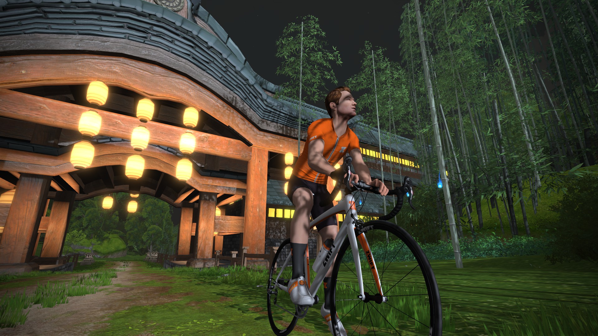
You’ll cover nearly all the Yumezi roads in the first 26km of your ride, but will return at the end to cover a final bit in the Castle area.
From Yumezi, we make our way over to urban Neokyo, which was the next section of Makuri Islands to launch, in November 2021. Neokyo is all bright lights and city streets, and the lights feel especially bright because it’s always night time in Neokyo. We’ll cover all of Neokyo roads here, before heading descending down Pain Cavern to Urukazi.

Urukazi is the tropical island portion of the Makuri Islands, and we’ll ride around it clockwise, doing two loops to cover all the roads. The first loop covers the inner roads, while the second loop covers the outer roads.

Then it’s up the Slot Canyon and back into Yumezi for the last bit of the route. You’ll ride through the lap banner once again and into the Castle area, covering a few internal roads. We finish our last bit of unridden pavement here as we ride through the Village Sprint, but we might as well carry on downhill for another 1.5km to finish up at the lap banner where we began.
Turn By Turn Directions
Be warned: this route has a lot of turns. Way more than any other Rebel Route we’ve ever done. You may want to print out a cue sheet.
Begin by choosing the Two Village Loop route, which starts you near the Yumezi lap banner, heading in the right direction for the first few turns.
- Right to Farmlands
- Left to Village Onsen
- Right to Village Onsen
- Straight to Village Onsen
- Right to Village Gardens
- Straight to Village Shops
- Left to Fishing Village
- Right to Castle Path
- Right to Castle Path
- Straight (Left) to Marketplace
- Straight (Left) to Marketplace
- Left to Forest Climb
- Left to Fishing Village
- Left to Fishing Village
- Left to Castle Path
- Right to Village Onsen
- Right (to Fishing Village)
- Left to Forest Climb
- Straight (Left) to Forest Climb
- Straight (Left) to Castle Path
- Straight (Left) to Marketplace
- Left to Castle Outskirts
- Right to Forest Road
- Straight (Left) to Forest Road
- Straight (Right) to Village Onsen
- Left to Rice Paddies
- Right to Neo Tower
- Straight (Left) to Neokyo
- Straight (Right) to Tower
- Straight (Right) to Tower
- Right to Harbor
- Left to Downtown
- Left to Downtown
- Right to Sky Lane
- Straight (Left) to Harbor
- Straight (Right) to Downtown
- Left to Arcade
- Straight (Right) to Arcade
- Left to Tower
- Right to Rice Paddies
- Right to Arcade
- Left to Downtown
- Left to Railway
- Left to Railway East
- Right to Rooftop
- Right to Railway East
- Left to Downtown
- Left to Downtown
- Straight (Right) to Castle Park
- Straight (Left) to Castle Park
- Right to Harbor
- Left to Urukazi
- Straight (Left) to Mangroze Maze
- Right to Mangrove Maze North
- Right to Festival Harbor
- Right to Festival Harbor North
- Right to Mech Isle
- Right to Mech Isle South
- Right to Hidden Reefs
- Right to Hidden Reefs
- Right to Mangrove Maze
- Left to Mangroze Maze South
- Left to Festival Harbor
- Left to Festival Harbor South
- Left to Mech Isle
- Left to Mech Isle North
- Left to Hidden Reefs
- Left to Yumezi
- Left to Yumezi
- Right to Farmland
- Straight (Right) to Castle Path
- Straight (Left) to Forest Road
- Right to Castle Path
- Right to Marketplace
- Right to Castle Outskirts
- Straight (Right) to Castle Outskirts
- Straight (Left) to Farmlands
Route details:
Distance: 80.9km (50.3 miles)
Elevation Gain: 650m (2132′)
Strava Segment
Rebel Route Suggestions
Got an idea for a great Rebel Route? Share it below and maybe we’ll publish a post about it!


I was just thinking we need a Watopia full map route & badge with all these new roads. Let’s hope these Rebel Routes get “official” status sooner rather than later!
The full Watopia is coming!
It better be 50k XP bonus badge 😂
The bonus is in the experience. 😆
Can the start be the summit of the Alpe😆
Here is my ride from January when I manually navigated all Watopia roads: https://www.strava.com/activities/13409498870
My route: Started in downtown Watopia – Fuego Flats – Southern Coast – Jungle – Alpe Du Zwift – Reverse Jungle – Mayan Bridge – Jungle back to Southern Coast – Mayan KOM – Itza KOM – down the lower section of the Grade – Grade KOM – Epic KOM – Radio Tower KOM – down the other side of Epic KOM – KOM bypass road – up the lower section of Epic KOM – U turn at Grade KOM – down to the tunnel towards downtown – Titans Grove – out and back to FF roundabout – back towards Italian Villas – Epic KOm reverse (lower section) – Jungle loop with turnaround at Mayan Bridge – back up towards Volcano – Jarvis Island – Volcano circuit – Volcano KOM – Esses to Hilly KOM reverse – finish with a short loop to include KOM bypass road and the short connector. This is not the most efficient route, but it has the big climbs early, so I was able to ride them while fresh instead of riding ADZ at the end. 180km total with 3,000 m elevation gain.
@Eric Schlange Just FYI: You no longer need to navigate manually if riding a Rebel Route (or any unofficial route that you want to ride on really) IF you’re a Sauce for Zwift user:
Earlier this month one of the Mods for S4Z (the Zenmaster mod) included a feature which allows you to build a route and then use its “Custom Route Chauffeur” feature to do the turning for you. If you have a Sauce ‘route profile’ window open then it’ll also display the route for you
👍
There is also a program called RoadCaptain. Also the same functionality without Sauce
Yup RoadCaptain.nl for anyone interested- someone told me about it on Discord later today when discussing the turns situation
Road Captain is a little disappointing. You can’t choose which direction to ride the segments in and there appears to be a limit on the number of segments you can use. I hit 34 trying to create the full Makuri, which was only about half the route.
You’d have to edit the json file to go in the opposite direction which looks like being very time consuming.
It’s a shame as I missed a turn in Neokyo and didn’t get a Strava time on the segment as a result.
Yeah, I’ve pondered doing the RoadCaptain thing for these, but have opted to keep it simple with a list of turns, as that works for everyone. Good to know Sauce can do it now too. What a time to be alive!
Pain cave problems 😂
Road Captain hasn’t been updated for over two years and it didn’t work then as it has Zwift authentication issues.
Sauce for Zwift is also close to useless for Rebel Routes as the designer thought it would be a good idea to not add a save/load feature to the route building feature. What he’s done is very good but why do 99% of the work and then not do the simple final percant which makes the feature usable?
@Jon The developer of the S4Z mod is working on a save/load feature, as well as GPX import (e.g. to easily import rebel routes).
I used this mod today for the Full Makuri. I actually did not find the “game connection” feature before doing it, so I did all turns manually, but the mod still told me where to go and that helped a lot. For the next rebel route I’ll let it control the turns.
It’s good to have new routes; I feel like the badges for any routes longer than about 50 miles should be hidden until you get them – a bit like the higher wattage badges – making them a special bonus for those who want them.
These days though that’d really only mean they were hidden until the first few people got them – no-one knows how to keep a secret anymore they just wanna be famous for sharing something new!
…I still wouldn’t be getting anywhere near the 1234watts badge though, lol!
I believe Paul is saying that they shouldn’t count for the total number of badges until you earn them, not that they would be a secret. Although if they were added as official routs they would still pop up in the route select screen, which I look at more than the list of badges so it wouldn’t matter very much to me.
IMO I feel the Uber Pretzel is the longest route that is interesting and wish they never added a badge for the PRL Full as the strength of Zwift is riding through interesting terrain to make riding on the trainer more bearable and the route is the opposite of that. Also it would make the PRL Full even more unbearable if they added a longer Watopia Full route as it would remove the challenge of riding the longest route in Zwift.
I have a nice idea for a rebel route, one that goes 4x to Radiotower, via Epic, Epic reverse, the Grade and Mayan Mountainside (and for the real masochists AdZ could be added as a finale)
I wanted to create such a route in Road Captain but unfortunately it’s too out of date
Might be a bit flat for some 🤪
I got a similar idea. In my case was starting with Oh Hill No for doing the grade, to radiotower as lead in because my route starts at the kom. descend epik reverse, epik bypass to climb epik reverse with radiotower, down the grade. Then Mayan and Itza untill radiotower, down Epik, cross the epik bypass to climb the full epik plus radiotower. Then Down the grade , itza and Mayan to end with climbung the grade and radiotower.
How did he avoid generating a route with u turns? Afaik all of the listed algorithms will happily give you a route with u turns, which is not a satisfying zwift route.
Only Ole understands his own wizardry…
Maybe you can ask him or put him in contact? Because I also have a version for watopia so it would be good to see if they are the same or different before you release the watopia one.
Here’s Ole’s ride for the Watopia one. Feel free to compare and let me know… you can also email me directly at eric@zwiftinsider.com… https://www.strava.com/activities/13117161406/overview
My program was able to find a route that is 152.94 km, so about 4km shorter. I’m working on getting it in a form that is understandable by someone other than myself and my turn numbering system, probably using https://zwiftmap.com/ I haven’t ridden it yet so it’s not on strava.
That Watopia route excludes part of the dessert roundabout. Simply looping it should solve it, but there may be more elegant solutions.
And also the dessert turnaround at the other side is excluded, which is harder to solve.
And to complete my nitpicking: also the roundabout at the bottom of the grade. Ofcourse it is a bit subjective whether you consider all these separate roads, or just another direction of the same road.
If you want to get really nit picky then if you look at various intersections there are small sections of separate road depending your starting and ending location (ie look at where flat route comes back to join hilly route). So it’s just degrees of “intersection”, where do you draw the line? Intersections like the one I just described? The small roundabout at the bottom of the grade? The large roundabout at the south end of the dessert? The turn around loop at the north of the dessert?
And then another can of worms is that repack rush is not included. And the short section of road before entering the climb portal is also not included.
Another problem: if you are ending the route at the top of alpe du zwift then you can’t end it at the actual banner because you haven’t done the little loop after the banner.
I did the Full yesterday, including the Repack Ridge, the desert roundabout and all other roundabouts and loops. It came in at 167km. https://www.youtube.com/watch?v=7ZT1E90j7i8&t=10s
Here’s a route that’s 153.6 km. https://zwiftmap.com/watopia/custom-route?points=-11.718678%2C166.966739%21-11.673722%2C166.950624%21-11.673907%2C166.94939%21-11.674838%2C166.949937%21-11.675181%2C166.954701%21-11.651175%2C166.962951%21-11.672939%2C166.966878%21-11.683913%2C166.931752%21-11.684652%2C166.926763%21-11.714654%2C166.956364%21-11.67443%2C166.98722%21-11.65509%2C166.973423%21-11.641619%2C166.971577%21-11.637432%2C166.964936%21-11.638983%2C166.956975%21-11.64455%2C166.955903%21-11.647418%2C166.949401%21-11.647756%2C166.94011%21-11.639792%2C166.943361%21-11.646315%2C166.948628%21-11.650529%2C166.952287%21-11.653077%2C166.924413%21-11.658907%2C166.925862%21-11.647247%2C166.934402%21-11.642834%2C166.938404%21-11.643846%2C166.939659%21-11.642355%2C166.935942%21-11.63938%2C166.948274%21-11.637033%2C166.954701%21-11.648398%2C166.953682%21-11.649051%2C166.961718%21-11.635149%2C166.975375%21-11.640117%2C166.976416%21-11.660951%2C166.984302%21-11.658504%2C166.971009%21-11.677308%2C166.966835%21-11.705694%2C166.963842%21-11.704119%2C166.934037%21-11.688109%2C166.935614%21-11.677755%2C166.933672%21-11.682113%2C166.887925
Impressive!
If you use Sauce then I think the mod route builder works well to letmyou vreate without u-turn issues, I’ve not yet tried it myself, just from what I hear 👍
Not Ole, but I suspect the trick is the combination of the 3 algorithms, presumably with adding turn penalties like https://www.sciencedirect.com/science/article/abs/pii/S037722171830609X
variations of this is used in GIS software for planning snow plowing and the like
That’s a lot of turns.
You’re not wrong. I got to navigate my bot through it, to make the Strava segment. And even THAT felt like a lot of work!
I TRIED IT BUT FAILED. GOT CONFUSED BC I THOUGHT ALL THE TURNS LISTED WERE
MANUAL BUT EVEN THE TURNS PART OF THE ROUTE ARE INCLUDED? Will try a shorter one
Zwift gets confused when you have caps-lock on. Try again after disabling it.
I loved it. I just did it with manual turns (using Zwift Play) and it was fun, I had to stay focused to follow the play.
that was a enjoyable endurance ride, thanks a lot! Can’t wait for the others.
Nice work, Martial!
In 2:12, also. You’re the first finisher, and you’ve set a solid time to beat!
Just finished, directions are spot on, thanks for creating the turn by turn road book @Eric Schlange ! Could not beat your time Martial, respect, second for know!
Fun Epic Race route when/if officially added!
Writing a program to solve this is cheating.
I started doing ‘the whole watopia’ way back when, and have done the updated version every time a road addition comes out.
I’ve done the whole makuri as well, but the neokyo mess makes it more of a workout on the brain than the legs. (That’s not a bad thing either, though).
I haven’t bothered with NYC. No interest. What a mess (in more ways than one).
The others are pretty straightforward, although France now has become more difficult to do efficiently with the new flatland labyrinth. Another brain workout 😏
Also– I don’t count the climb portals. They have been deemed separate maps.
Okay, then what is the route that you found?
Tim – here is my Watopia all roads route, I rode it in January (described in more detail in another comment on this page). I didn’t use any optimization; I just had an idea for a route and navigated from memory. I also rode Alpe du Zwift early while I was still fresh (Ole’s route finishes with ADZ which is harder in my opinion). My route is 180 km: https://www.strava.com/activities/13409498870
Is there an updated turn-by-tun list for KOM Monster v1 with the new roads considered since it was initially developed?
Not yet. That’ll be v2. 😃
Just rode this route. Very engaging since you are averaging a turn every km.
If I’m being very nitpicky I would update turn 52 from
Straight (Left) to Urukazi
to
Left to Urukazi
The straight option is the one of the right but other than that, everything else is spot on.
Nice work! Fixed #52 above.
yes
Did the route today, but failed twice and needed u-turns. Will try again, when it will getvaa badge.
Good work to figure this out and providing the road book.
Here is my Makuri 100k route that covers all roads, I rode it 2 years ago: https://www.strava.com/activities/8283758148
I didn’t use any algorithm to optimize the route, and I rode extra distance to cover 100k. I started with the Neokyo All-Nighter route to cover all Neokyo roads, then manually navigated through Yumezi and Urukazi to cover every single stretch of road.
@Ole Eichhorn and @Eric Schlange: Thank you so much for this really wonderful route and the perfect spot‑on directions! I rode this route last week and really loved it! (Last year I did my own version of the Full Makuri Islands, but it was 2k longer and had some U‑turns, so it wasn’t as enjoyable as your wonderful route.) If I may make a suggestion, I would like to update turn #28 from “Left to Neokyo” to “Straight (Left) to Neokyo”.
I’m looking forward to the Full Watopia of Ole 😊
Done. Thanks!
Has the full WATOPIA page been created yet Eric? Cheers
Publishing next week!
Which one are you publishing? The longer one that you created a segment for the or the shorter one that I found above? https://zwiftmap.com/watopia/custom-route?points=-11.718678%2C166.966739%21-11.673722%2C166.950624%21-11.673907%2C166.94939%21-11.674838%2C166.949937%21-11.675181%2C166.954701%21-11.651175%2C166.962951%21-11.672939%2C166.966878%21-11.683913%2C166.931752%21-11.684652%2C166.926763%21-11.714654%2C166.956364%21-11.67443%2C166.98722%21-11.65509%2C166.973423%21-11.641619%2C166.971577%21-11.637432%2C166.964936%21-11.638983%2C166.956975%21-11.64455%2C166.955903%21-11.647418%2C166.949401%21-11.647756%2C166.94011%21-11.639792%2C166.943361%21-11.646315%2C166.948628%21-11.650529%2C166.952287%21-11.653077%2C166.924413%21-11.658907%2C166.925862%21-11.647247%2C166.934402%21-11.642834%2C166.938404%21-11.643846%2C166.939659%21-11.642355%2C166.935942%21-11.63938%2C166.948274%21-11.637033%2C166.954701%21-11.648398%2C166.953682%21-11.649051%2C166.961718%21-11.635149%2C166.975375%21-11.640117%2C166.976416%21-11.660951%2C166.984302%21-11.658504%2C166.971009%21-11.677308%2C166.966835%21-11.705694%2C166.963842%21-11.704119%2C166.934037%21-11.688109%2C166.935614%21-11.677755%2C166.933672%21-11.682113%2C166.887925
Obviously the shortest should be published. I’m sure @Eric Schlange agrees, right?
Of course. Already working on it with Tim!
Thanks Eric
@Eric Schlange Thanks for this route, directions were spot on! One minor detail, there was 728m of climbing not 650.