“Tour of Tewit Well” Route Details (Yorkshire)

One of six routes rolled out with Zwift’s UCI 2019 Worlds Yorkshire map, “Tour of Tewit Well” covers the course’s larger southern circuit in a counter-clockwise direction.
In the 18th and 19th centuries, Harrogate made its fortune by drawing often wealthy people to come and drink its waters, which had a supposedly curative effect.
Tewit Well was discovered in 1596, and named after the local word for peewit or lapwing, a bird common to the Stray parkland where the well is located.
Route Basics
Length: 10.8 km (6.7 miles)
Elevation: 204m (669‘)
Map: Yorkshire
ZIMetrics
Rating: 6.7/100 🛈
Time Estimates 🛈
lead-in + first lap
4 W/kg: 18 minutes
3 W/kg: 21 minutes
2 W/kg: 27 minutes
Start & Finish
Free rides start just before the lap banner. Events begin in the pens just after the lap banner. Lap ends at the lap banner.
Format: Loop
Ride Achievement Badge: 210 XP
Run Achievement Badge: none
Leaderboard Segments |
| Yorkshire KOM Reverse @0.7km (1.2km, 4%) |
Strava Segments
BestBikeSplit Model
Estimate ride time, IF and TSS, plan your power, and more!
Route Description
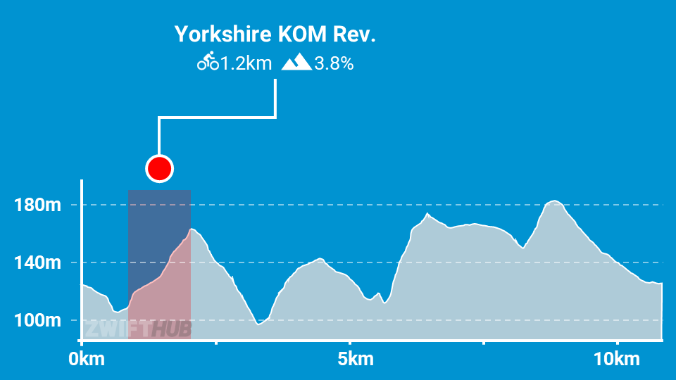
Route profile by ZwiftHub – the place to plan and track your route achievements!
Beginning before the start/finish banner, you will quickly turn left near the Royal Pump Room and begin the reverse KOM segment. This is the only timed segment on the route. Finish that climb then descend down the backside and over the Oak Beck stone bridge.
Most of the loop after this point is fairly straight roads at gentler inclines and declines, except for the Pot Bank section which will surprise you with its short, steep section (15%+). In real life, this is a twisty, narrow bridge. Zwift has retained the steepness and curves but widened the roads for our safety.
Make your way through the fields, wave hello to the friendly farmers and their cows and sheep, and you’ll find yourself back in Harrogate soon enough. The route ends as you cross the start/finish banner.