“The London Pretzel” Route Details (London)

At the time of its release, the “London Pretzel” route was the only route covering all London roads. In fact, it covered them all in both directions. The route leaves off newer additions to the London course, but it’s still a fun one if you’re looking for a longer ride with a mix of flat efforts broken up by two decent climb sections.
At the time of its release, the “London Pretzel” route was the only route covering all London roads. In fact, it covered them all in both directions. The route leaves off newer additions to the London course, but it’s still a fun one if you’re looking for a longer ride with a mix of flat efforts broken up by two decent climb sections.
Route Basics
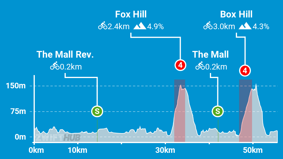
Length: 55.7 km (34.6 miles)
Elevation: 571m (1,873‘)
+0.6km (0.4 miles) lead-in with 4m (13‘) elevation
Map: London
ZIMetrics
Rating: 29.2/100 🛈
Time Estimates 🛈
lead-in + first lap
4 W/kg: 84 minutes
3 W/kg: 94 minutes
2 W/kg: 116 minutes
Start & Finish
Format: Loop
Ride Achievement Badge: 1100 XP
Run Achievement Badge: none
Leaderboard Segments |
| The Mall Sprint Reverse (0.2km, 1.1%) |
| Fox Hill KOM (2.4km, 4.3%) |
| Box Hill KOM (3km, 4.4%) |
Strava Segments
BestBikeSplit Model
Estimate ride time, IF and TSS, plan your power, and more!