“Achterbahn” Route Details (Innsbruck)

“Achterbahn” is German for rollercoaster, but this challenging route is a lot more work than any rollercoaster you’ve ever taken. Covering all Innsbruck roads in both directions, this figure 8 route is almost 20km longer than Watopia’s Figure 8, with 4x the elevation gain!
“Achterbahn” is German for rollercoaster, but this challenging route is a lot more work than any rollercoaster you’ve ever taken. Covering all Innsbruck roads in both directions, this figure 8 route is almost 20km longer than Watopia’s Figure 8, with 4x the elevation gain!
Route Basics
Length: 47.4 km (29.5 miles)
Elevation: 989m (3,245‘)
+0.2km (0.1 miles) lead-in with 1m (3‘) elevation
Map: Innsbruck
ZIMetrics
Rating: 30.6/100 🛈
Time Estimates 🛈
lead-in + first lap
4 W/kg: 83 minutes
3 W/kg: 94 minutes
2 W/kg: 122 minutes
Start & Finish
Spawn point and event start pens are just before the downtown Innsbruck lap banner, which is where this route ends.
Format: Loop
Ride Achievement Badge: 950 XP
Run Achievement Badge: none
Strava Segments
BestBikeSplit Model
Estimate ride time, IF and TSS, plan your power, and more!
Route Description
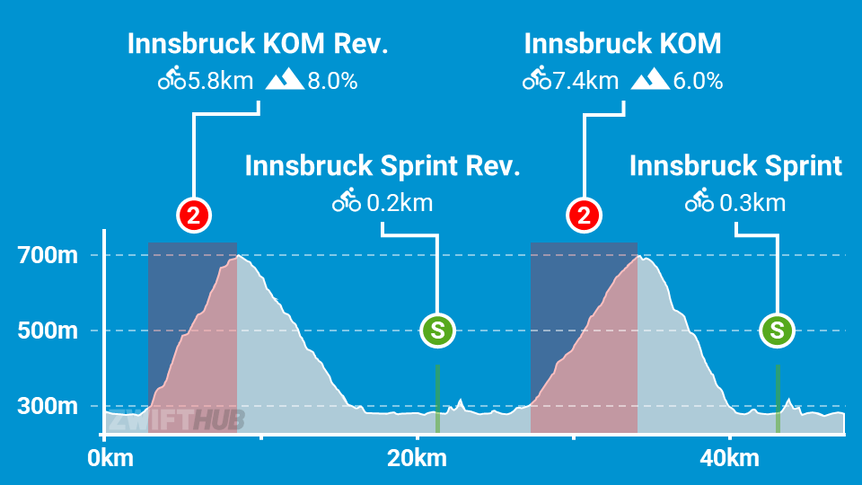
Route profile by ZwiftHub – the place to plan and track your route achievements!
This is the longest route in Innsbruck. It begins at the start/finish line, but takes you over the steep reverse KOM first, then over the forward KOM before ending at the start/finish. Along the way you’ll hit the sprint next to the Inn river in both directions.