“Island Outskirts” Route Details (Makuri Islands)

Taking in (almost) all of Urukazi’s outermost roads, this loop gives you a tour of the island group, taking you to the highest point on the map along the way.
Taking in (almost) all of Urukazi’s outermost roads, this loop gives you a tour of the island group, taking you to the highest point on the map along the way.
Route Basics
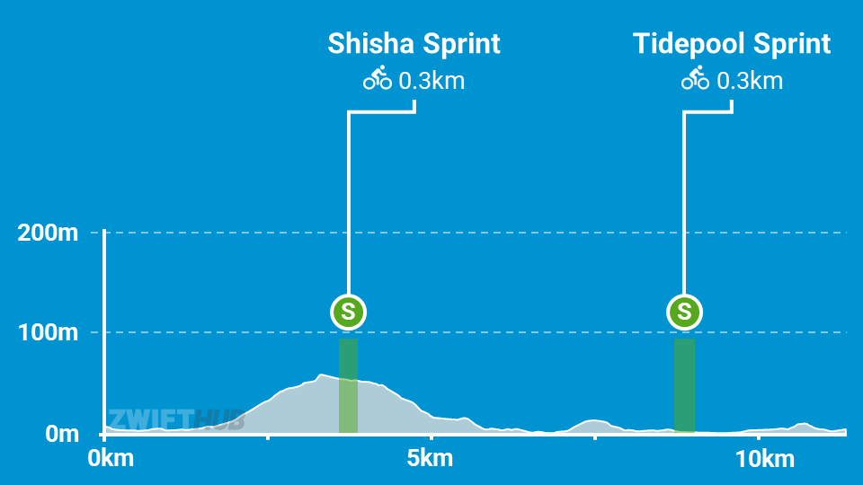
Length: 11.4 km (7.1 miles)
Elevation: 90m (295‘)
+0.1km (0.1 miles) lead-in with 2m (7‘) elevation
Map: Makuri Islands
ZIMetrics
Rating: 5.7/100 🛈
Time Estimates 🛈
lead-in + first lap
4 W/kg: 17 minutes
3 W/kg: 18 minutes
2 W/kg: 23 minutes
Start & Finish
Starts and ends at a virtual banner just north of the Mech Isle pens.
Format: Loop
Ride Achievement Badge: 225 XP
Run Achievement Badge: none
Leaderboard Segments |
| Shisa Sprint (0.29km, 0.7%) |
| Tidepool Sprint (0.31km, 0%) |
Strava Segments
Bike Selection
Go aero! While this route has a bit of climbing, the climbs are short and slack enough that an aero bike delivers uphill performance slightly better than a climbing bike. See Fastest Frames and Wheels at Each Zwift Level >
Route Description
Route profile by ZwiftHub – the place to plan and track your route achievements!
Begin at the Mech Isle start pens and travel along the northern, paved shoreline of Mech Isle before taking the bridge across to Festival Harbor. Here you’ll turn right and soon begin climbing up to the Shisa Sprint. This is the biggest climb on the route, so be ready to go hard if you’re racing.
Once you reach the top, catch your breath and take in a quick view of Urukazi from your elevated perch… then it’s time to descend back to the boardwalk!
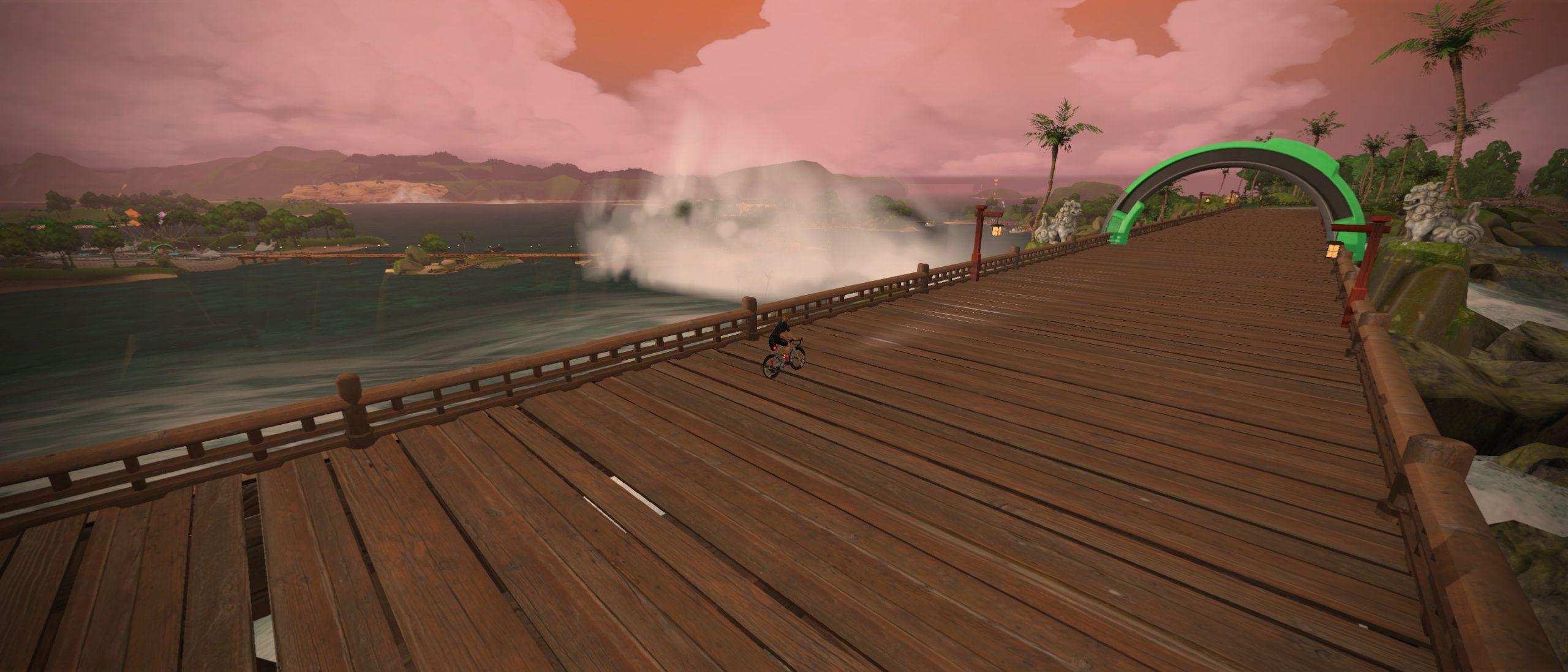
From the boards of Festival Harbor you’ll head across the beach to Mangrove Maze, where you’ll turn left to (oddly) take the inner road of Mangrove Maze. A bit of a climb here, but nothing substantial. Then you’ll descend back to the beach to hit the Tidepool Sprint before turning left and making your way to the Mech Isle virtual start/finish banner.