“Flat Route” Route Details (Watopia)
Route Basics
Length: 10.2 km (6.3 miles)
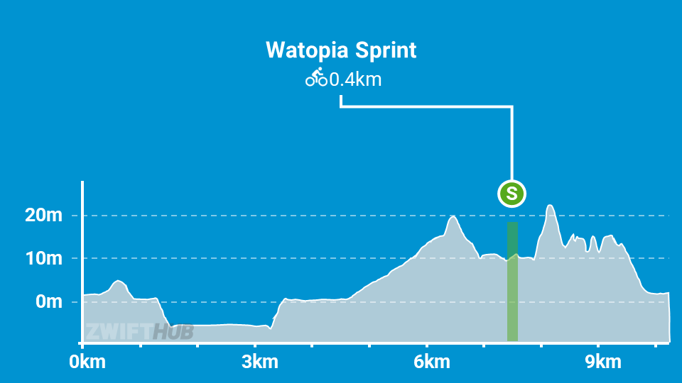
Elevation: 61m (200‘)
+0.1km (0.1 miles) lead-in with 2m (7‘) elevation
Map: Watopia
ZIMetrics
Rating: 4.9/100 🛈
Time Estimates 🛈
lead-in + first lap
2 W/kg: 19 minutes
3 W/kg: 16 minutes
4 W/kg: 14 minutes
Start & Finish
Starts and finishes at downtown Watopia arch.
Format: Loop
Ride Achievement Badge: 200 XP
Run Achievement Badge: none
Leaderboard Segments |
| JWB Sprint (0.36km, -0.1%) |
Strava Segments
Bike Selection
As the name implies, this route is quite flat. So aero rules the day! Get the most slippery frame and wheels you can afford.
Fastest Frames > Fastest Wheels >
Related Posts
BestBikeSplit Model
Estimate ride time, IF and TSS, plan your power, and more!
Route Description

Route profile by ZwiftHub – the place to plan and track your route achievements!
