Introduced in Zwift’s May 2021 Yumezi launch, Spirit Forest is a figure 8 route that keeps you in the Temple KOM area, without actually completing any KOMs!
Related Posts
Introduced in Zwift’s May 2021 Yumezi launch, Spirit Forest is a figure 8 route that keeps you in the Temple KOM area, without actually completing any KOMs!
Related Posts
Route Basics
Length: 8.4 km (5.2 miles)
Elevation: 134 m (440‘)
Lead-In: 4 km (2.5 miles)
Map: Makuri Islands
Start & Finish
Begins at island spawn point before Fishing Village. Finishes atop the Temple KOM.
Achievement Badge: 170 XP
Sprint & KQOM Segments |
None |
Strava Segments
Bike Selection
A gravel bike will give you the most balanced advantage here. Choose a good climber!
Related Posts
Route Description

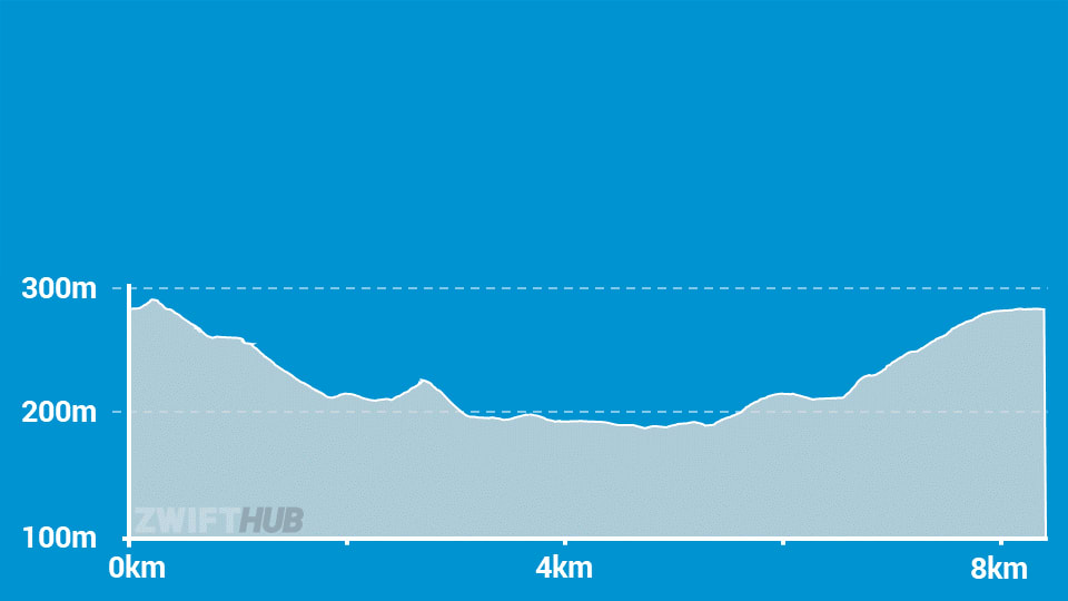
Route profile by ZwiftHub – the place to plan and track your route achievements!
This route has the longest lead-in of any Yumezi route at 4km length, with a good chunk of climbing!
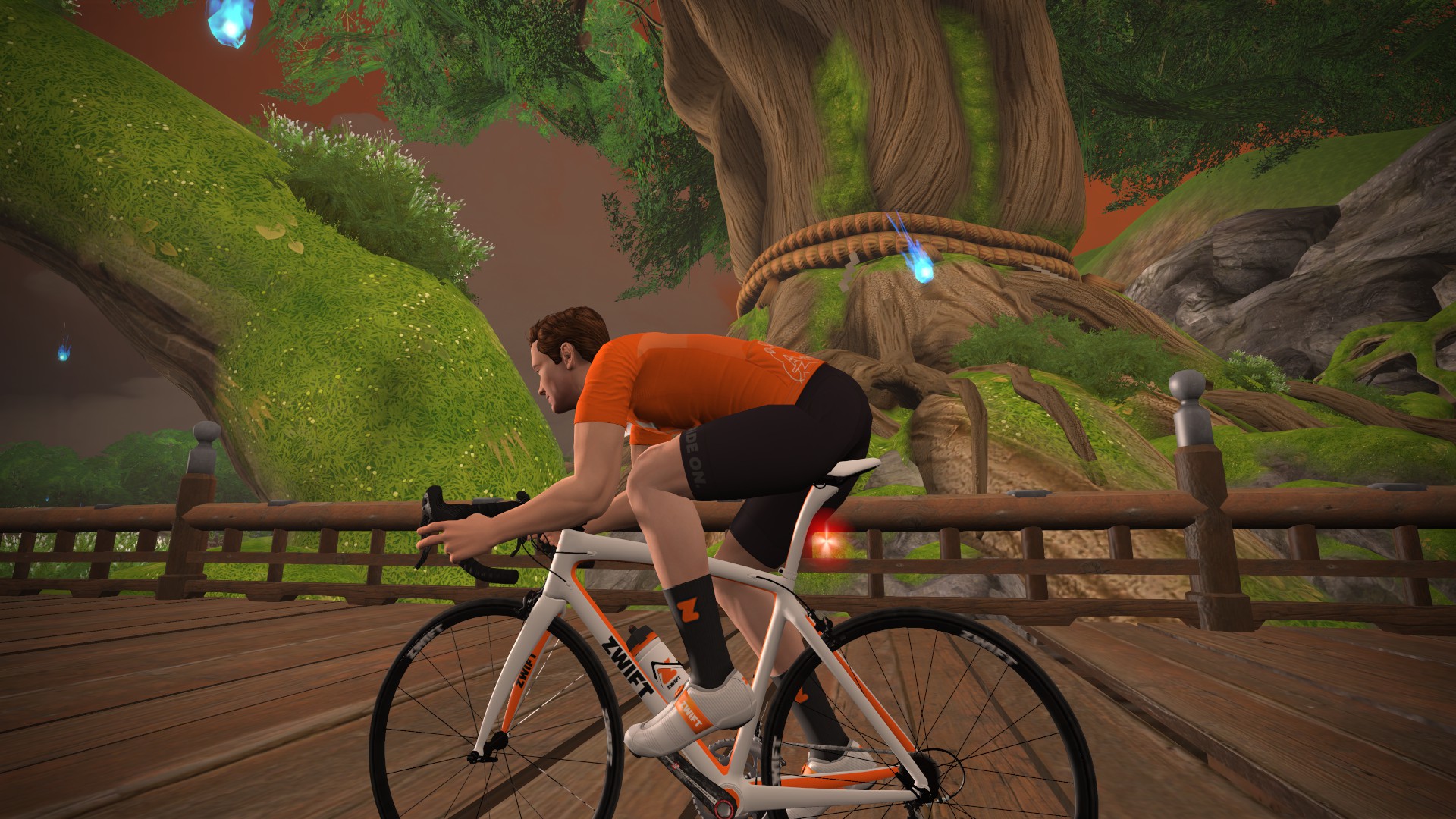
We spawn on the island just before the Fishing Village. Ride over the bridge, through the Village, then turn left onto the dirt and begin your climb. But instead of finishing the KOM from this side, you’ll cut across on the bypass trail, then finish the KOM from the Castle side. Once you ride through the KOM arch at the giant tree, the actual route begins.
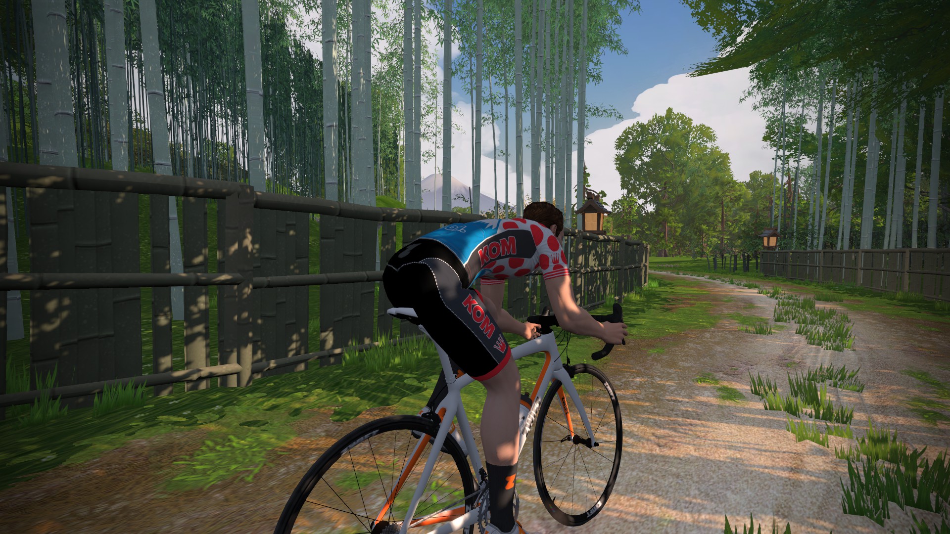
From here you’ll descend toward the Fishing Village, take the bypass trail, descend to the Castle, then cut across to the Fishing Village area where you’ll begin it all over again.
It’s 12.6km with 244m of climb – about 30-40mins for most. Let’s just drop the lead in nonsense and call a spade a spade!
Yup they are 2 completely different rides. It is pointless to describe as you have @eric SCHLANGE
That’s only true if all you ever do is ride the whole thing once to get the badge.
If (as I often do) you want to pick a shortish route and then do a number of laps then it is important to understand which but is the lead in (that you will only do the first time) and which is the actual route that you will do the rest of the laps on.
I would say Eric does a good job of making that totally clear.
I agree — I’ve never understood the lead-in concept. If my buddy asked if i wanted to go on a 20-mile ride, I’d say sure! But if we started pedaling and he then said, “Oh, those first five miles didn’t count — the total is going to be 25,” I’d be annoyed (and tired!)
Lead-ins are so that there are common start points for multiple routes (usually). Also they have to spread out the users when you start, so there needs to be a spot where everyone can cross to start the route. As well, lead-ins allows the route that the created to be a loop (in this case, they could have sent the riders north, then west, to make a slightly bigger loop) And your analogy makes no sense. If you say you’re going to do an X mile ride, then do an X mile ride. But if your buddy asks if you… Read more »
Plus an extra 1.6km (14km total, 258m elevation) if you do it from the event pens. 🤣
could you mark if the roads are gravel or tarmac. or am I missing something on the map?
Plaese help me understand how the lead in works here. If I am planning to do 5 laps the first lap would be approx 12.5km with something like 250m of climbing. And then? Each lap 8.4km with 134m of climbing? Is that correct? So in 90min, I would say 18min per lap plus approx 15min for the additional 4km in the beginning? so 4-5 laps should be possible in approx 90min?
I find these route details extremely helpful (thanks Eric!). I can appreciate the benefit of a lead in especially if doing multiple laps. But as an older cyclist recovering from surgery I would appreciate not only the length of the lead in but the elevation also. And the terrain (gravel = tediously slow, vs pavement) but maybe that’s just being greedy…thanks again Eric!
I really enjoyed this one (well…enjoy might be a strong word, haha). The climb efforts are more closely matched to what I find around here so I can gauge a “real world” effort when I’m doing specific hill training.
It’s a nice little route that doesn’t get very much attention.